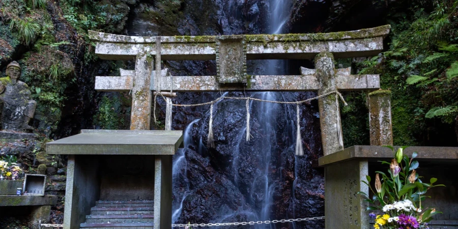
Kuya Falls (空也の滝, Kuya-no-taki) drops about 15 metres down a chert cliff at the foot of Mount Atago, in the wooded hills north-west of Kyoto. It is nothing like the scale of Kegon Falls or Nachi Falls, and that is precisely its charm.
The stream feeds the Kiyotaki River, and the site carries centuries of spiritual history. The mid-Heian monk Kūya, who lived from about 903 to 972, is said to have trained here, and the falls still bear his name. Stone torii and lanterns line the last stretch of the approach, and statues of Fudō Myōō, an Eleven-Faced Kannon and ascetic figures stand beside the pool. This is not a viewing platform: it is a working site of Shugendō practice, and you may well arrive to find someone standing under the water.
Overview
The Kuya Falls hike
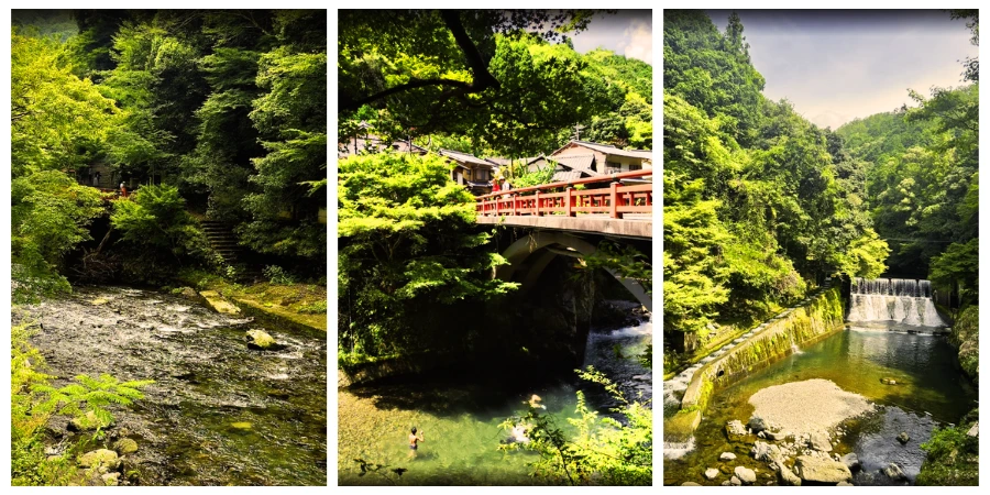
The walk starts at the hamlet of Kiyotaki and runs about 2.5 kilometres up the Tōkai Nature Trail, which follows the Kiyotaki River before turning uphill towards the falls. Kiyotaki also sits midway on the longer valley route between Takao and the Hozukyō gorge, so the falls can be folded into that day if you want a fuller walk. The trail weaves through forested hills, crossing small streams and gentle slopes, with stone markers and weathered shrines along the way.
The path stays shaded almost the whole way, with cedars and moss keeping the air cool even in August. The return trip usually takes around two hours at a relaxed pace. For those planning day hikes from Kyoto, Kuya Falls provides a calm alternative to the crowds at Arashiyama: it feels more like a local mountain walk than a sightseeing hotspot.


What to wear at Kuya Falls
The trail is not especially steep, but it can be muddy after rainfall and uneven in places. A pair of sturdy boots or hiking shoes will make the route much more comfortable. During summer in Japan, lightweight clothing and insect repellent are useful; in colder months, pack an extra layer for the shaded valley.
Kuya Falls is also suitable for families with older children who enjoy the outdoors. The distance is moderate and the riverside setting keeps younger walkers interested, though the last stretch to the pool is uneven and worth taking slowly.
Getting there
The simplest approach is to get to Kiyotaki and walk up from there. From Hankyu Arashiyama, Kyoto Bus 62 runs to the Kiyotaki stop in about 15 minutes for ¥230, and the falls are a 2.5 kilometre walk beyond it. The alternative is to make a linear day of it: JR to Hozukyō, or a bus to Takao, and walk the valley through Kiyotaki, with the falls as a detour partway along.
Parking is limited around Kiyotaki and Takao and fills up at weekends, so the bus is usually the easier option. For walkers, the route is signed, with occasional markers pointing towards Kuya-no-taki. A paper map is worth carrying if you plan to link this trail with the paths that climb on towards Atago Shrine or run deeper into the Kitayama range.
Public transport tips
- Kyoto Bus 62: Hankyu Arashiyama → Kiyotaki (15 min, ¥230). This is the closest stop to the falls.
- JR Sagano Line: Kyoto → Hozukyō (20 min, ¥240)
- JR Bus Takao and Keihoku Line: Kyoto Station → Takao. Note that Kyoto City Bus 8 also serves Takao, but it starts from Shijō-Karasuma, not Kyoto Station.
From Takao, follow signs for Jingo-ji Temple and continue down to the river, then upstream through Kiyotaki for the falls.
The journey itself is part of the appeal, running out past the edge of the city into forested hills within half an hour of Kyoto Station.







Kuya Falls map

Google Maps lists the falls as 空也滝, but phone signal in the valley can be patchy, so download the area before you set off. Printed trail maps are available at the tourist centre in Kyoto Station, and several walking sites publish route sketches that combine the falls with Jingo-ji at Takao.
Map of Kuya Falls
Close by attractions
- Jingo-ji Temple: Famous for its autumn maples, this temple sits just before the Kuya Falls turn-off.
- Arashiyama nature walk: Two train stops away, offering bamboo groves and river views.
- Atago Shrine: the main Atago-san trail climbs on from Kiyotaki to the shrine at 924 metres, a much harder day but the same starting point.
For a longer day, the paths above Kiyotaki connect on to Tsukinowa-dera, another temple tied to Kūya, and from there to the Atago summit.
Reasons to visit
Waterfall lists tend to favour the big cascades, which is exactly why this one stays quiet. The combination of an easy riverside walk, a site still used for ascetic training, and a mountain that rises straight out of the city edge makes it a good half day for anyone who would rather not queue.
Once you are past Kiyotaki there is very little but water and birdsong, which is rare enough within an hour of Kyoto Station to be worth the trip on its own.